Why should I choose Hungary as a hiking destination?
What can provide Hungary to a hiker, if it doesn't have any seaside and high mountains?Arrival and travel in Hungary
What to do if you arrive by plane or train? About the tickets of the public transport in the capital, about the travel in countryside by trains or coaches.Entry and exit points of the National Blue Trail
Where are those points along the Blue Trail, which has good accessibility with public transport (train or coach)?About accommodation and wild camping
Wild camping in Hungary? YES! - only with a few limiting conditions. When and where is fire ban in the forests? Accommodations in guesthouses, tourist houses. About the prices.About money and shopping
The money of Hungary. A replacement of banknotes happened in Hungary! Which banknotes are in circulation and which are already withdrawed? About credit cards. About the shopping in towns and in villages.About the Hungarian language and people
A few useful Hungarian phrases. About the mentality of Hungarian people. Why Hungarians don't speak foreign languages?A Hungarian speciality: the dogs
Why Hungarians keep dogs in the yards in coutryside? How can you enter in the yards? What to do, if you encounter a stray dog?About the Gypsies (Roma people)
The history of the Roma population in Hungary. What is the recent situation? Is there any solution? Should we afraid of Gypsies?About the weather of Hungary
The description of the Hungarian weather. Explanation and diagrams about the Hungarian seasons.Hiker maps and the signs of the hiker paths
About hiker maps, the guidebooks of the National Blue Trail. About the different trail markings of the paths. Hiker map softwares for mobile phones.Information about the stamping
About the stamping: should you stamp during the hike, or not? Where can you buy the personal validation booklet? How can you find the stamps? How can you obtain the badge of the National Blue Trail?The view of Szent György-hegy and Csobánc mountains taken from the ruins of Castle of Szigliget
Panorama from the rocky forehead of Kőszikla Hill
Panorama of Budapest from the Hármashatár-hegy Mountain
In the Gorge of Pilis
I have been thinking for a long time about how I could draw up, why is Hungary a good hiking destination? Hungary is a small country in the centre of Europe, without seaside and high mountains. Why is it worth coming here and walk many dozen or many hundred miles among hills and small villages? I have found an answer on the blog of a German hiker and globe-trotter, Christine Thürmer, who hiked on the National Blue Trail. I would like to quote a few thoughts from her description:
 Did I like this hike? Yes, indeed! I liked it tremendously. This has been an incredibly pleasant and relaxing hike. Although it has not been very spectacular it has been very enjoyable - and Hungary has surpassed my expectations be far! Why? I had expected a rather flat country and was positively surprised to find the Kektura landscape to be relatively hilly in parts - especially in the Eastern part. So I had plenty of really beautiful views. Plus the forest was extremely pittoresque in Indian Summer. Would I recommend this hike to a friend? Yes, absolutely and I would go even further: Kektura is a real insiders' tip for outdoor novices. Why do I recommend it especially for beginners? There are several reasons:
Wild camping is legal and easy: Most beginners are worried about wild camping which is illegal in most of Europe. Therefore they tend to go Scandinavia or Scotland where wild camping is legal under the “every man's right”. But what hardly anybody knows: Wild camping is legally allowed in Hungary - except in National Parks. I was so surprised about that that I double checked it various times but all my sources agreed: German guidebooks, the English Kektura website, my Hungarian friends and even a forester I met on the way. And it is dead easy as well: on the Kektura you walk through forest most of the time. And as the landscape is rather flat or hilly at best it is usually very easy to find a flat spot for your tent! So no need to go to Scandinavia or Scotland especially out of reason number two:
Hungary has a high margin of error: Let me explain what I mean with this. Beginners tend to commit more mistakes than experienced hikers. And if things go wrong you somehow have to get out of the situation. In Scandinavia this can be tricky: The weather is usually adverse, in the North there is not much shelter from forest and if you have to bail out it will cost you a fortune due to the high price level in Scandinavia. Hungary is so much more “forgiving”: The weather is moderate, there is not much altitude or exposed areas and you are mostly walking in forest where you are sort of sheltered from the elements. Plus the waymarking is so good that is difficult to get lost. But if you have to bail out it will be cheap: Hungary has a great and very cheap public transportation system that serves literally every little settlement. The infrastructure is great with little shops in almost every village. Water is not an issue due to an abundance of public water fountains in every settlement. But most important: Accommadation is plentyful and cheap: I usually paid between 15 and 25 EUR for one person. So if the weather turns bad or you are simply too tired you can just treat yourself with sleeping in a bed under a roof!
High fun factor: Due to the relatively low price level you can easily treat yourself once in a while - with sleeping in a cosy bed or eating in a restaurant. I loved the food which was always really good quality at cheap or moderate prices. As you can see I especially liked the desserts. And I should not forget to mention that a glass of wine will set you back less than 1 EUR! Plus Hungary is full of thermal baths and it is so relaxing to soak in hot water after a long day of hiking. A visit to a thermal bath will set you back something between 5 to 10 EUR - just bring a swim suit.
Honestly, I don't understand at all why Hungary is not more popular as a hiking destination. Ok, it lacks alpine scenery, but it offers an abundance of beautiful decidouos forest where you will probably not see a single soul in days but plenty of wildlife. In no other country I have seen so many deer, wild pigs and mufflons. Hungary is very sparsely populated and you will definitely see a lot less people on the Kektura than on the Kungsleden in Sweden. Plus it is so cheap and easy to get there. Both low cost airlines Ryanair and Easyjet fly from Germany to Budapest.
So if you look for an interesting new hiking destination go to Hungary - you won't regret it! 
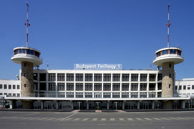
Budapest - Ferihegy-1 Airport Terminal
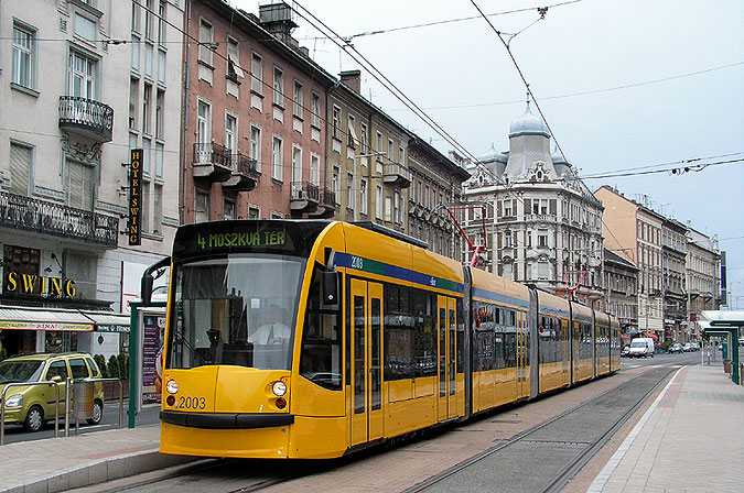
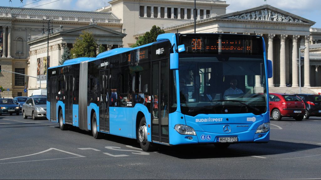
International airports are only in Budapest, so you will arrive to the capital from abroad. There are two airports beside each other close to the border of Budapest. The old terminal is the Liszt Ferenc Repülőtér 1, and it is used by only a few airliners, they are mainly charter flights. The new terminals are the Liszt Ferenc Repülőtér 2A and 2B. The blue public transport busses number 100E and 200E start from Ferihegy 2A and 2B airport terminals on the arrival level. The bus number 100E is a direct bus to the centre of Budapest, the travelling time is about 40 minutes. You can use it with special ticket, its price is 900 HUF, you can buy it at the bus stop from ticked machines. The bus number 200E goes to the terminal of the underground line number 3 (Metro line 3 or M3) at Kőbánya-Kispest railway station, and has a station at the old terminal. The travelling time with this bus is 20 minutes. You can travel farther with M3 to the downtown (it is a further 15 minutes long travel). Three underground lines of Budapest cross each other at the Deák tér (Deák Square), this is the geometric centre of the capital. Here is the terminus of the bus number 100E, and the underground line number M3 has a stop on the square.
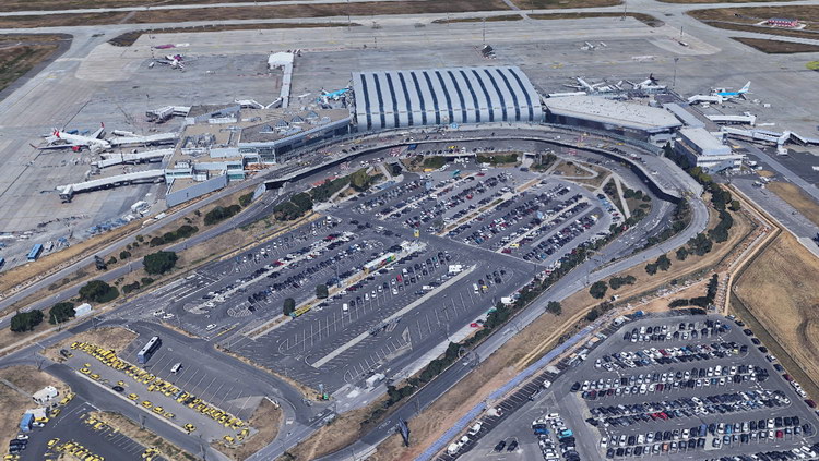
Budapest - Ferihegy 2A and 2B Airport Terminals on the Google Earth
The busses start really often, in every 10-15 minutes. There is another possibility, you can use the Airport minibuses. One travel to the downtown is 2.300 HUF/person and the travelling time is about 30 minutes. This service has information desks on both airports, you can inform and book the travel there. Of course the fastest transfer is the taxi. The Főtaxi Company has taxi stations at every terminal. A travel to the centre of Budapest is about 4000-5000 HUF – it depends on the distance and the travelling time.
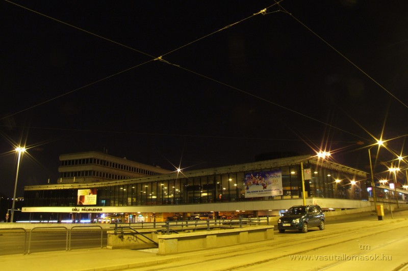
Budapest - Déli Railway Station
Budapest is the centre of the Hungarian railway lines and the international trains have a stop here. There are three main railway stations almost in the centre of the capital, and the international trains use all of them. Their names are Keleti pályaudvar (Eastern Railway station), Nyugati pályaudvar (Western Railway Station) and Déli pályaudvar (Southern Railway Station). Their names don't refer to their position in Budapest and don't refer to the direction of the arriving and leaving trains. Why have got they these names? I don't know! But all the three railway stations have a good accessibility with the M2 and M3 Metro lines.
The public transport is really cheap and good in Hungary, if you will travel to the countryside from the capital, your trains will depart from the above mentioned railway stations. You will find a table about the good entry and exit points of the National Blue Trail below, I write exactly there, which station is the departure point of trains going in different directions.
There are single tickets of the public transport company in Budapest, which are valid on the trams, busses, underground (Metros) and HÉV (suburban railway from Budapest to the neighbour villages) until the boundary of Budapest. You can buy them on the airports and anywhere at the newspaper or tobacco shops, or at the ticket offices of the Budapesti Közlekedési Vállalat (BKV) - in English: Public Transport Company of Budapest. Generally you can find the offices at the railway stations, at the bigger Metro stations and at the big public transport junctions.
You have to validate a new ticket at every travel! You can't change and travel farther with one ticket! You will find many ticket validating devices on the handrails of busses and trams. But there are many busses, mainly in the outskirt of Budapest, where you can use only the first door to get on. In this case you have to show the new ticket to the driver, and validate it with that device, which is mounted at the first door.
The situation is a little bit different at the underground lines! There are no ticket validating devices on the trains, you must validate the ticket when you enter the area of the underground. This ticket will be valid in the next 80 minutes, or until you leave the area of the underground! It means literally, you can change among the underground lines many times.
Important: If you travel in the town with the public transport vehicles, you will meet often with the inspectors of the public transport company! Don't pretend, you don't understand them, because they will call the police (or a policeman is with them), and they will escort you to the police station. The travel conditions are in Hungarian/English/German versions on the windows of the vehicles!
If you would like to spend more days in Budapest to get to know the sights of the capital, I recommend you to buy some travel card. You can use them without any limitation on every bus, tram, Metro and HÉV line of the BKV until the boundary of Budapest. They are valid even on the cog railway among the hills of Buda! You can buy them only at the ticket offices of the BKV.
| Name (English) | Name (Hungarian) | Description | Price |
|---|---|---|---|
| Single ticket | Vonaljegy | It is valid at one travel | 350 HUF |
| Single ticket bought on the spot (at the driver) | Vonaljegy | It is valid at one travel | 450 HUF |
| Short section metro ticket | Metró rövid szakaszjegy | It is valid to travel maximum 3 stops | 300 HUF |
| Block of 10 tickets (10 pcs) | 10 darabos gyűjtőjegy | It is valid for 10 single travel | 3000 HUF |
| 24-hour travel card | Napijegy | It is valid for a day | 1650 HUF |
| 72-hour travel card | 72 órás jegy | It is valid for three days | 4150 HUF |
| Seven-day travel card | Hetijegy | It is valid for seven days | 4950 HUF |
| Budapest card (for 48 hours) | Budapest kártya 48 órás | It is valid for two days, its cost contains free entry in museums. MORE | 9900 HUF |
| Budapest card (for 72 hours) | Budapest kártya 72 órás | It is valid for two days, its cost contains free entry in museums. MORE | 12990 HUF |
You can find further information about the tickets and the fees on this website: http://www.bkk.hu/en/tickets-and-passes/prices/ . I think, the single tickets are a little bit expensive, but it is worth buying some travel card, if you will spend longer time in Budapest. The public transport is very good in Budapest, you can get to everywhere with the public transport vehicles!
Here is a map about the public transport lines of the whole Budapest. It shows always the momentary state of the lines. It is downloadable in PDF format from the website of the Public Transport Company of Budapest:
http://www.bkk.hu/apps/docs/terkep/budapest.pdf
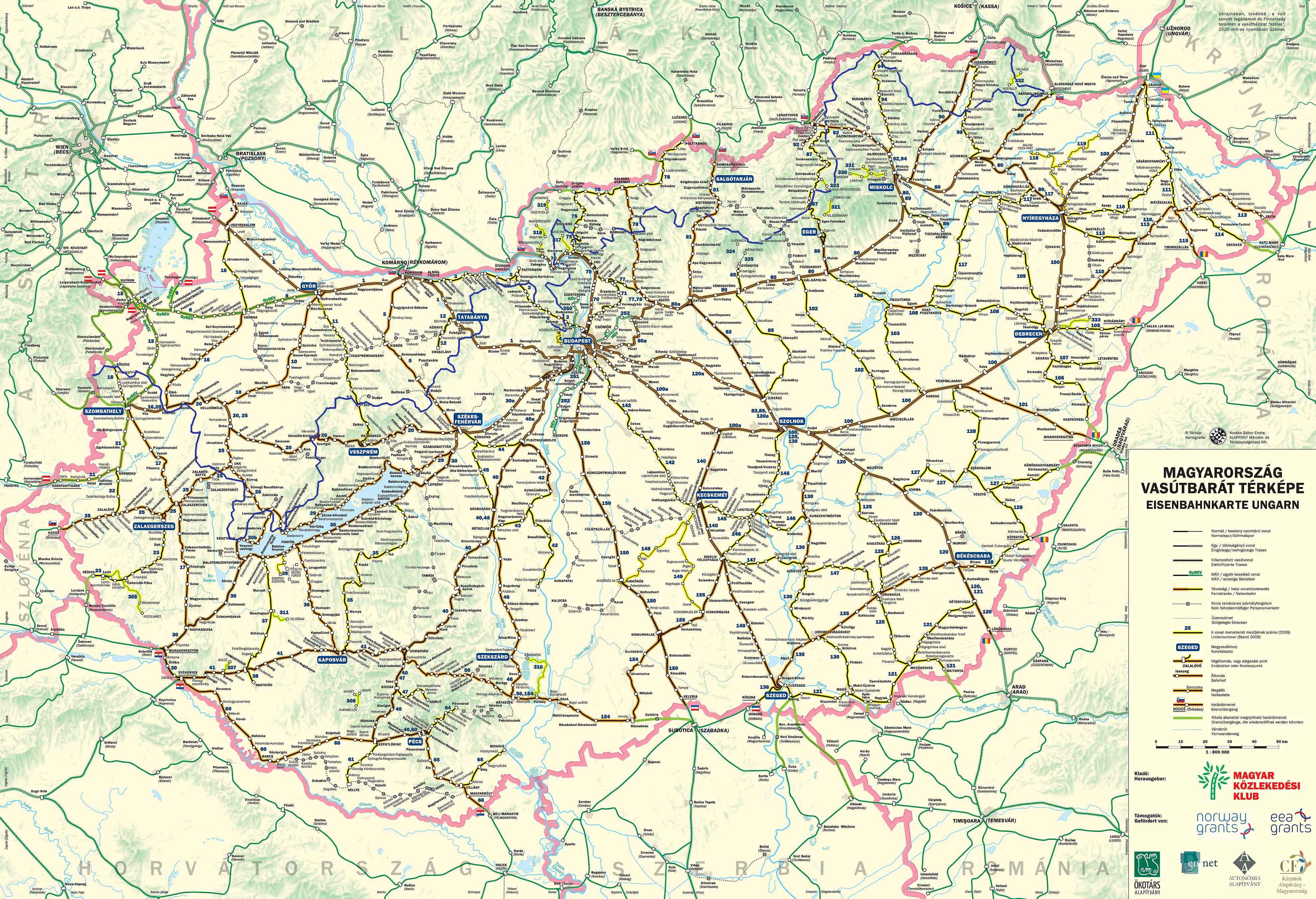
THE HUNGARIAN RAILWAY LINES AND THE ROUTE OF THE NATIONAL BLUE TRAIL
If you click onto the map, it will open in bigger size.
Budapest is the centre of the Hungarian railway lines and they start from the earlier mentioned three main railway stations. There is a very good timetable of the MÁV (Hungarian State Railways), its address is the following: http://elvira.mav-start.hu . This website has German and English version, as well.
You can reach many places of the Blue Trail by long distance coaches, as well. They start from Budapest and they have two main terminals. The name of the first is Budapest Népliget buszpályaudvar (Budapest, Népliget Bus Station), it is accessible by the Metro3 line, and the name of the second one is Budapest Stadion buszpályaudvar (Budapest Stadion Bus Station), you can reach it with the Metro 2. The coaches start towards the western part of Hungary (towards the Transdanubian region) from the Népliget Station and towards the eastern half of the country from the Stadion Station.
You can reach the timetable of the long distance coaches here:
https://menetrendek.hu/ Unfortunately it has only Hungarian version, but on one hand it is suitable to plan your travel only by busses (click on “Csak busz járatok”), on the other hand you can start a combined search with bus and train together (Busz, vonat és hajó járatok).
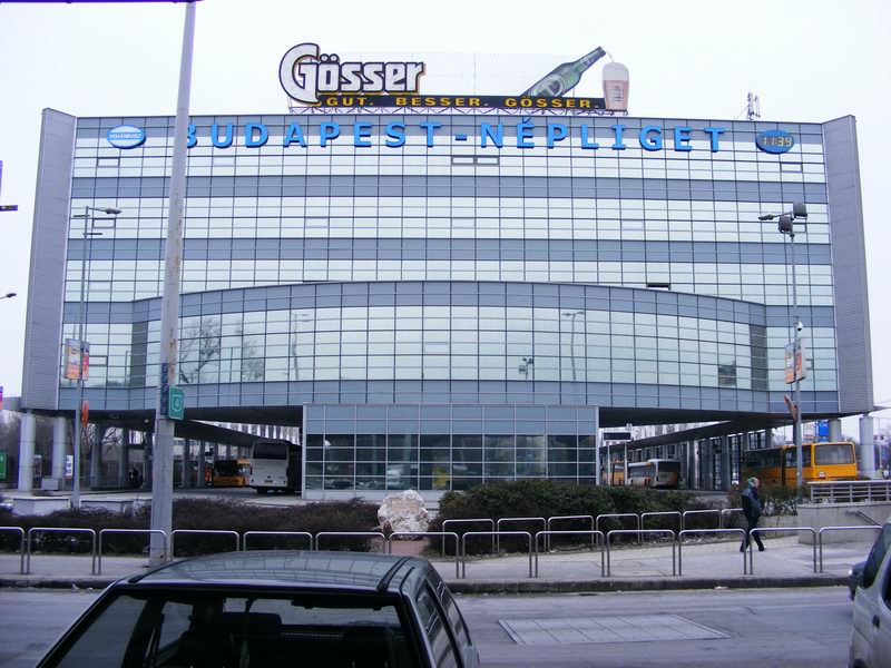
Budapest - Népliget Bus Station
These busses start from bigger Hungarian towns, which are in good connection with Budapest by train or long distance coaches, and they carry the people from the towns to the smaller settlements in their environs. Generally the bus stations are close to the railway stations. Usually the long distance coaches and the inter-settlement busses use the same terminals. Of course Budapest is an exception: there are many terminals only for the inter-settlement busses in the capital.
You can find their timetable here:
https://menetrendek.hu/ (yes, you can find every long distance and inter-settlement busses in common timetable).
The prices of the coaches and trains are the same in same distances. I tell you only some prices as examples (December 2019):
- 50 km distance 930 HUF
- 100 km distance 1860 HUF
- 200 km distance 3410 HUF
You can find the whole chart of prices here: http://www.volan.hu/dijszab/jegyar.pdf . These prices are valid from January 2016 on the second class of the railway, on the long distance coaches and inter-settlement busses. These prices don't contain the additional price of the seat reservation and the first class of the trains.
There is a passionate Blue Trail walker man, its nickname is Heyjoe, who made a very good map with the all access points of the whole route of the big Blue Circle. It is accessible on his website:
https://heyjoe.hu/kiszallas/index.php#8/47.300/19.498/alap-kiszallas-oktThe Blue Circle contains three blue trail routes, the longest one is the National Blue Trail, its southeastern part is the Blue Trail of the Plain (Alföldi Kéktúra) and the third one is the South-Transdanubian Blue Trail (Dél-dunántúli Kéktúra) on the southwester part of Hungary. Now the northern route, the National Blue Trail is important for us. The map shows the whole route of the Blue Circle and you will find small bus and train icons along the marked route. If you click onto the icons you will get the time tables of trains or busses, which are valid today!
As you can see, there are a lot of entry and exit point along the route of the National Blue Trail, because every Hungarian settlements has public transport access and the route crosses many main roads, as well. Of course there are entry/exit points, which are better and faster accessibility from Budapest, than others. I try to give you a short list about these places and a short description how can you travel there. The map details are from the http://www.turistautak.hu online hiker map. I use this map to the planning of my hikes.
I will write the travel to every places from Budapest, because it is the biggest public transport hub in Hungary!
| Place | Travel | Approach |
|---|---|---|
| The western trailhead: Írott-kő Mountain | The trailhead does not have fast accessibility from Budapest, but it is an important place!
You have to travel from Budapest to Szombathely town. There are direct trains between the towns: the Intercity trains depart from the Keleti Railway Station, the express trains starts from the Déli Railway Station (it is a simple and self-evident thing, or not? :-)) The distance between the railway station and bus station in Szombathely is about 1.4 km on the Szelestey László Street (it begins in front of the station) and on its continuation, on the Petőfi Sándor Street. Inter-settlement busses start to Velem village many times a day. |
The fastest way to reach the summit, if you start the hike from Velem village (it is located exactly at the foot of the mountains), you can find the descriptions of this route in the travelogue. The lenght of the path marked with  and later with and later with  signs is about 5.9 km with 540 metres climb from Velem until the top of Írott-kő. signs is about 5.9 km with 540 metres climb from Velem until the top of Írott-kő.
The route in online map |
| Kőszeg town | You have to travel by train from Budapest (from Déli or Keleti Railway Staton) until Szombathely town, and change on the railway station. There is a local train between Szombathely and Kőszeg, its depart is in 15 minutes after the arrival of the train from Budapest. | The National Blue Trail crosses Kőszeg town, it leads through the old downtown. The railway station is located at the southern border of the town, the distance is about 1.5 km between the station building and the route of the Blue Trail on the long Rákóczi Ferenc utca.
The route in online map |
| Sárvár town | You have to travel with express train from Budapest Déli Railway Station (via Székesfehérvár) directly until Sárvár town. It is the penultimate stop of express trains before Szombathely. | The National Blue Trail crosses Sárvár town, it leads through the centre. The railway station is located at the border of the town, the distance is about 1.1 km between the railway station and the bridge of the Nádasdy Castle on the winding road of  marks. Attention! There are two branches of the marks. Attention! There are two branches of the  trail marking from the railway station towards two different points of the Blue Trail! trail marking from the railway station towards two different points of the Blue Trail!
The route in online map |
| Sümeg town |
|
The National Blue Trail touches the railway station of Sümeg, it is a stamping place.
The place in online map |
| Keszthely town | You have to choose those express trains from Budapest Déli Railway Station, which go to Nagykanizsa and have direct wagons to Keszthely. You have to travel with the wagons going to Keszthely. | The distance is appr. 500 metres from the railway staton to the route of the Blue Trail on the Kazinczy Street.
The route in online map |
| Tapolca town | You have to choose those trains from Budapest Déli Railway Station, which go directly to Tapolca via Székesfehérvár and on the northern shore of the Balaton Lake. These trains go only between Spring and Autumn, wintertime you have to change in Székesfehérvár. | The National Blue Trail touches the railway station of Tapolca, it is a stamping place.
The place in online map |
| Badacsonytördemic village | You have to choose those trains from Budapest Déli Railway Station, which go directly to Tapolca via Székesfehérvár and on the northern shore of the Balaton Lake. These trains go only between Spring and Autumn, wintertime you have to change in Székesfehérvár. Trains have a stop at Badacsonytördemic-Szigliget railway station. | The National Blue Trail touches the railway station of Badacsonytördemic, it is a stamping place.
The place in online map |
| Nagyvázsony village | There are direct couches from Budapest Népliget Bus Station, which touches Nagyvázsony. | The distance between the bus stop and the Blue Trail is about 200 metres on the Vár Street.
The route in online map |
| Városlőd-Kislőd railway station | You have to choose those trains from Budapest Déli Railway Station, which go directly to Szombathely via Székesfehérvár and change to local train in Veszprém, which goes farther on the same line, because express trains don't stop at Városlőd-Kislőd railway staton. | The National Blue Trail touches the railway station of Városlőd-Kislőd, it is a stamping place.
The place in online map |
| Zirc town |
|
The railway station and the bus stop in the downtown are on the route of the National blue Trail
The place in online map |
| Csókakői elágazás bus stop | You have to travel by couch from Budapest Népliget Bus Station to Székesfehérvár bus station and change another bus to Mór town. This bus has a stop on the main road no. 81 at the access road of Csókakő village. | The National Blue Trail touches this bus stop, when it crosses the main road no. 81 between Bodajk and Csókakő settlements.
The place in online map |
| Szárliget village | You have to travel with local train from Budapest Déli Railway Station directly until Szárliget railway station. | The National Blue Trail touches the railway station of Szárliget, it is a stamping place.
The place in online map |
| Dorog town | There are direct trains from Budapest Nyugati Railway Station to the railway station of Dorog (this railway line goes to Esztergom). | The National Blue Trail touches Dorog railway station, it is a stamping place.
The place in online map |
| Piliscsaba town | There are direct trains from Budapest Nyugati Railway Station to the railway station of Piliscsaba (this railway line goes to Esztergom). | The National Blue Trail touches this railway station, the stamping place is close to the station.
The place in online map |
| Budapest, Hűvösvölgy | You have to use the tram no. 56 or 56A from the Széna tér Square to Hűvösvölgy terminus. | The terminus of the Children's Railway is about 5 minutes walk on stairs and promenades from the terminus of the tram. The railway station is a Blue Trail stamping place.
The route in online map |
| Budapest, Rozália Brickyard | You have to use the green local train M5 from the Batthyány tér Square to Szentlélek tér Square and change there to the bus no. 218. Travel this bus until the stop named “Solymár, téglagyári bekötőút”. | You will reach the route of the Blue Trail on the access road of the brickyard (marked with  signs) with about 500 steps walk at the railway crossing. There is a Blue Trail's stamp at the gate of the factory. signs) with about 500 steps walk at the railway crossing. There is a Blue Trail's stamp at the gate of the factory.
The route in online map |
| Nagymaros village | There are direct trains from Budapest Nyugati Railway Station to the railway station of Nagymaros (this railway line goes to Szob and father to Slovakia) | The railway station is a Blue Trail stamping place, the route of the Blue Trail crosses the railway line at the station.
The place in online map |
| Nógrád village | There are direct trains from Budapest Nyugati Railway Station to the railway station of Vác (this railway line goes to Szob and father to Slovakia) and you have to change to the local train, which goes to Balassagyarmat. It has a stop at Nógrád village. | The route of the National Blue Trail goes beside the small railway station of Nógárd. There is stamping place beside the railway station.
The place in online map |
| Becske village | There are direct trains from Budapest Keleti Railway Station to the railway station of Aszód (this railway line goes to Hatvan) and change to the local train going to Balassagyarmat. You have to travel with it until “Becske alsó” railway stop. | The route of the National Blue Trail and the centre of the village is about a half an hour long walk from the railway stop on a low traffic asphalt road marked with  signs. signs.
The route in online map |
| Mátraverebély village |
|
The route of the National Blue Trail touches the bus stop and the small railway station. There is stamping place beside the railway station.
The place in online map |
| Mátraháza holiday resort | There are direct busses from Budapest Stadion Bus Station to Mátraháza holiday resort. | The route of the National Blue Trail touches the bus station of the settlement, it is a stamping place.
The place in online map |
| Szarvaskő village | There are direct coaches from Budapest Stadion Bus Station to Szarvaskő village. | The route of the National Blue Trail crosses the main road no. 25 in the centre of the village, at the bus stop. The pub beside the bus stop is a Blue Trail's stamping place.
The place in online map |
| Putnok village | There are direct express trains and Intercity trains from Budapest Keleti Railway Station to the railway station of Miskolc and you have to change to the local train there, which goes to Bánréve. It has a railway station at Putnok village. | The route of the National Blue Trail touches the railway station, it is a stamping place.
The place in online map |
| Bódvaszilas village | There are direct express trains and Intercity trains from Budapest Keleti Railway Station to the railway station of Miskolc and you have to change to the local train there, which goes to Tornanádaska. It has a railway station at Bódvaszilas village. | The route of the National Blue Trail crosses the village, does not touch the railway station, but it is a stamping place. You can reach the route of the Blue Trail with about 500 steps walk on the streets marked with  signs. signs.
The route in online map |
| Encs town | There are direct express trains and Intercity trains from Budapest Keleti Railway Station to the railway station of Miskolc and you have to change to the local train there, which goes to Hidasnémeti. It has a railway station at Encs village. | The route of the National Blue Trail crosses the railway line, the railway station is about 300 steps on the short access road of the station. kbut it is not a stamping place.
The route in online map |
| Sátoraljaújhely town | There are direct express trains and Intercity trains from Budapest Keleti Railway Station to the railway station of Miskolc and you have to change to the local train there, which goes to Sátoraljaújhely. | The route of the National Blue Trail doesn't cross the town, it runs above the settlement in the Sátor-hegyek Mountains. You can reach the Blue Trail on the route of  , later on the route of , later on the route of  signs in the Nagy-nyugodó Col from the railway station. The lenght of the route is about 3.3 km long with 270 metres climb. signs in the Nagy-nyugodó Col from the railway station. The lenght of the route is about 3.3 km long with 270 metres climb.
The route in online map |
| The eastern trailhead: Hollóháza village | It does not have fast accessibility from Budapest, but it is an important place! There are direct express trains and Intercity trains from Budapest Keleti Railway Station to the railway station of Miskolc and you have to change to the local train there, which goes to Sátoraljaújhely. The station of the local busses is located in front of the building of the railway station. There are direct local busses to Hollóháza, you have to travel with them until the final stop of Hollóháza. | The route of the National Blue Trail begins/finishes here, at the bus turning place. The pub beside the bus stop is a Blue Trail stamping place.
The place in online map |
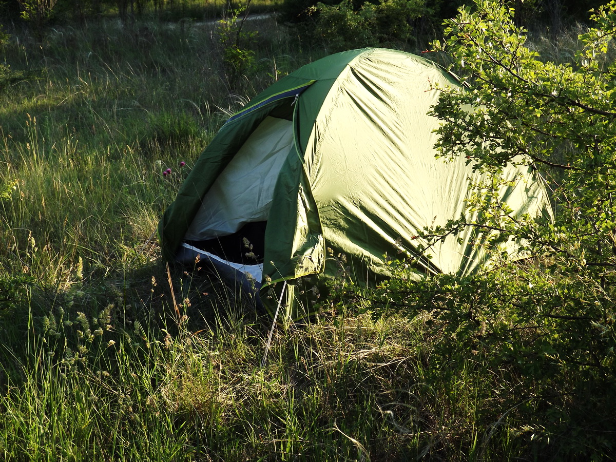
Wild camping in the forest
Details from the “Erdőtörvény” (Law of forest):
91. § (1) Az erdőben - annak rendeltetésétől függetlenül - üdülés, sportolás és kirándulás céljából gyalogosan, emberi erővel hajtott kerékpárral, lóval, valamint az erdészeti feltáró hálózat részein sport vagy turisztikai célú, lóval vontatott járművel bárki saját felelősségére ott tartózkodhat, amit az erdőgazdálkodó tűrni köteles, kivéve, ha
a) más jogszabály azt korlátozza, vagy
b) az arra jogosult a látogatás korlátozását az e törvényben foglaltak alapján elrendelte.
93. § (1) Az erdőgazdálkodó hozzájárulásával szabad az erdőben:
a) huszonnégy órát meghaladóan üdülési, illetőleg sportolási célból tartózkodni, táborozni, továbbá sátrat felverni;
I try to translate it with my own words:
91. § (1) Anybody can stay in the forest independently from its function on grounds of recreation, sport and trip by walking, cycling, horse riding, or on grounds of sport and tourism by horse towed vehicles on his/her own risk on the forest cultivating roads, and the forest management must tolerate this thing. Exceptions:
a) if this is limited by other laws
b) authorized person has ordered the limiting of visits in the forest on grounds of the above mentioned laws
93. § (1) It is allowed in the forest with the approval of the forest management:
a) to stay on ground of recreation and sport, to pitch tent and camping more than 24 hours long
Literally it means, that we, hikers have right to pitch camp everywhere in the forest, if the duration of the camping doesn’t exceed the 24 hours! The wild camping is allowed! Unfortunately the situation isn’t as simple as we hope. The stay and the camping is strongly limited on the protected areas, for example in national parks or in nature reserves.
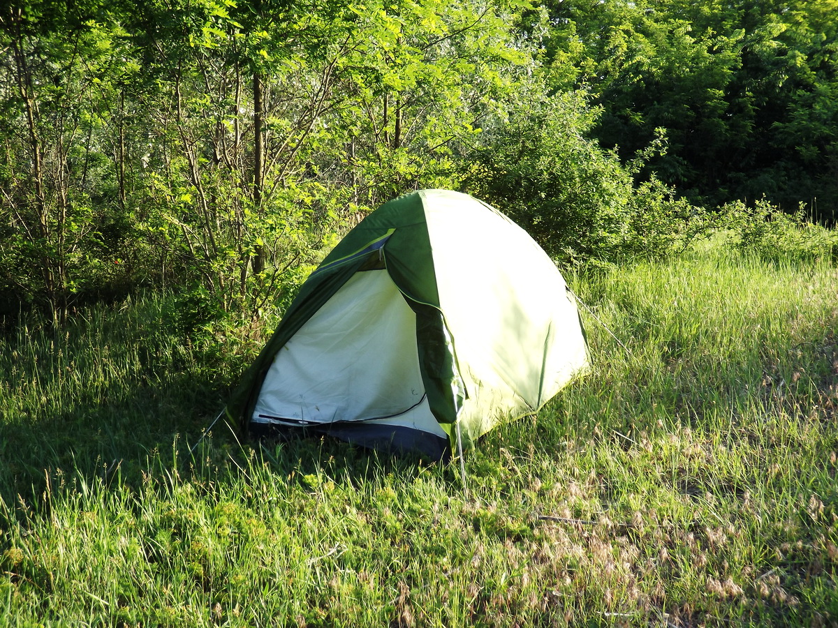
Wild camping in the forest
I can write only my opinion here:
I spent altogether more, than 100 nights in my tent during the past dozen years (I have a little statistics about my hikes), a big part of them in nature reserves. I met many times with foresters, but I didn’t have any problem with my wild camping in the mentioned areas. Why? The answer is simple: foresters know, that hikers love the nature, they won’t harm it! If I break camp, I leave nothing there, only the trace of my tent in the grass. Generally foresters and hikers are in a good relationship, but it is only at the walking hikers. If somebody tries to pitch camp beside his car/motorbike, foresters will send him to an official camping. But the above written facts are right for a few people. 4-6 people still can “lost” in the forest, bigger teams are already more conspicuous. In this case foresters generally prohibit the camping in the protected areas. But there are strongly protected areas on the route of the Blue Trail, where a wild camping is really prohibited! These areas are the Plateau of Bükk Mountains between Bélapátfalva village and Mályinka village and the shore of Lázbérci-víztároló Reservoir between Dédestapolcsány and Uppony villages.
Of course, the wild camping is allowed by the mentioned law only in the forest, and on its meadows, clearings, clear-cuts. The Law of Forest doesn’t say about the wild camping in the fields, arable areas. But I know from my experience, there is no problem in this case. Only one thing is important: don’t harm the forest and the plants of the cultivated areas!
- There are only a few official campsites (camping) along the Blue Tail. You will find them mainly in bigger towns or in the environs of bigger sights (for example in the Danube Bend, Lake Balaton, Cave of Aggtelek, etc).
- There is a good website, where you can look for camping in the whole area of Hungary in seven languages (of course it has English and German version, as well): http://www.camping.hu
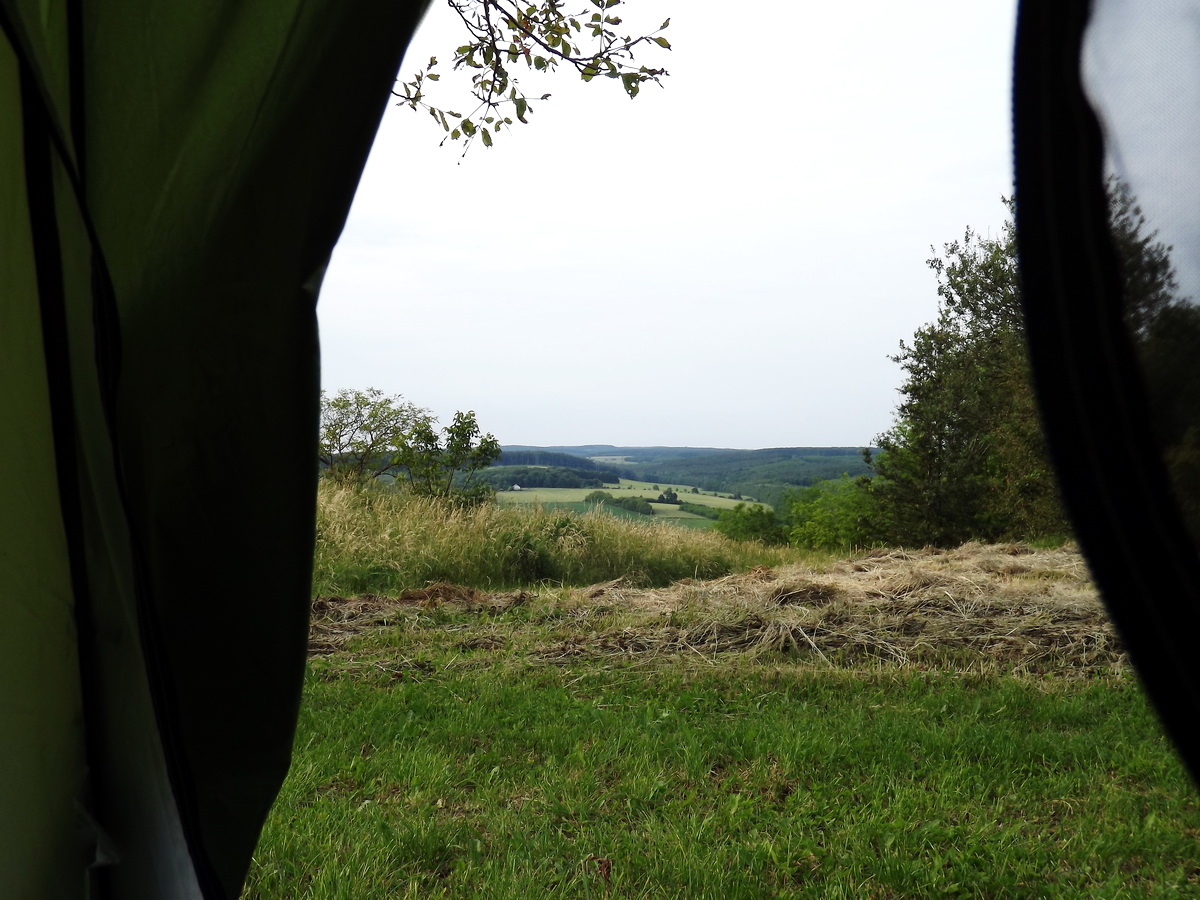
View from my tent
Notice:
Generally there is a total fire ban (see later) in the forest and its 200 metres wide environs between spring and autumn, because of the dry Hungarian summers.
And finally some pieces of advices from me:
- Look for a nice, hidden clearing or meadow in the forest far from the settlements to pitch your tent.
- If there is/are hunters' highstands in the environs, do not pitch your tent in the shooting line. In this case the best position is to put the tent in the closest environs of the highstand, so the hunter will see you.
- Do not pitch camp beside or onto the path, but stay in the vicinity of it.
Summertime generally there is a total FIRE BAN in the forest and its 200 metres wide environs because of the dry Hungarian weather! In this case to make fire is totally forbidden even at the built fireplaces of resting places! You can check the current status of the fire ban on this website:
https://tuzgyujtasitilalom.nebih.gov.hu/Areas painted with red color in the map show those counties of Hungary, where making fire in the nature is prohibited!
You can find accommodation in almost every village, which is crossed by the path of the National Blue Trail. There is a very good website, which collects the accommodations along the Blue Circle, I recommend to visit it, when you are planning a hike along the National Blue Trail:
http://kekszallas.irottkor.hu/fooldal
There are good general Hungarian websites, where you can look for guest houses/hotels along your hike:
- http://www.szallasinfo.hu/szallasinfo/index.php Hungarian/English/German
- http://www.szallasjegyzek.hu Hungarian/English/German
- http://www.iranymagyarorszag.hu/keres/magyarorszag/szallasok/panziok-p1/
Of course, you can use the well-known https://www.booking.com/, as well
If you don't find a settlement among the offer of the websites and you have to spend nevertheless a night on that place, you have many possibilities: either look for the “Zimmer Frei” boards on the walls of the houses - it is a German phrase and it means that they have a free room for the tourists - or ask for information in the shop or in the pub.
Only a few tourist hostels work beside the route of the National Blue Trail. They offer less services than guest houses, for example you won't get dinner or breakfast, the rooms don't have toilet and lavatory, because they are on the corridor, or you have to share a room with other people, etc.
The key houses are tourist hostels without staff. If you book the accommodation in a key house, a person will hand over the key of the house and you have to give back the key, if you leave the accommodation. Generally there is a kitchen and lavatory beside the sleeping rooms, and the guests have to keep the order and cleanliness in the houses. Of course, every sleeping room have an unique key.
I would like to recommend a few accommodations along the National Blue Trail, I collected them mainly from the publicatons of the Hungarian Rambler Association and completed them with my personal recommendation.
| Name | Address and availability | Description |
|---|---|---|
| Stájer-házi Erdészeti Erdei Iskola (Forest School of Forestry in Styer Houses) |
|
|
| Szent Imre Lelkigyakorlatos Ház (Spiritual Practice House Named Szent Imre) |
|
|
| Tömörd Önkormányzat Vendégháza (Guesthouse of the Concuil of Tömörd Village) |
|
|
| Borostyánkert Étterem és Vendégház (Borostyánkert Restaurant and Guesthouse) |
|
|
| Laky Demeter Turistaház (Laky Demeter Tourist House) |
|
|
| Kaán Károly Kulcsosház (Kaán Károly Key House) |
|
|
| Balatoncsicsói Erdészház (Forester's lodge of Balatoncsicsó) |
|
|
| Balaton-felvidéki Erdészeti Erdei Iskola (Forest School of Forestry of Balaton-felvidék Region) |
|
|
| Kinizsi Turistaszálló (Kinizsi Tourist House) |
|
|
| Iglauer Park, Városlőd (Iglauer Park, Városlőd village) |
|
|
| Németbányai Vendégház (Guesthouse of Németbánya) |
|
|
| Erdőismereti Oktatóbázis és Kismesterségek Háza (Forest Education Training Base and Craft House) |
|
|
| Bakonyvári Vadszőlő Szálló és Étterem (Bakonyvári Vadszőlő Restaurant and Hotel) |
|
|
| Bagolyvár Fogadó (Bagolyvár Guesthouse) |
|
|
| Bakonyi Kemping (Camping of Bakony) |
|
|
| Tölgyestábor Turistaközpont (Tölgyestábor Tourist Centre) |
|
|
| Hangistálló Művészszálló (Hangistálló Artist Hostel) |
|
|
| Gránás Turistaház (Gránás Tourist House) |
|
|
| Maróthegyi Sólyomfészek (Maróthegyi Sólyomfészek) |
|
|
| Erdészház Turistaszálló (Forester's Lodge Tourist House) |
|
|
| Hármashatár-hegyi Turistaház (Tourist House of Hármashatár-hegy Mountain) |
|
|
| Som-hegyi Turistaház (Tourist House of Som-hegy Hill) |
|
|
| Báró Eötvös Lóránd Menedékház (Báró Eötvös Lóránd Tourist House) |
|
|
| Mogyoró-hegyi Tábor (Camp of Mogyoró-hegy Hill) |
|
|
| Törökmezői Turistaház (Törökmező Tourist House) |
|
|
| Kisinóci Turistaház (Kisinóci Tourist House) |
|
|
| Nagy-Hideg-hegyi Sí- és Túraközpont (Ski and Hiking Centre of Nagy-Hideg-hegy) |
|
|
| Katalinpusztai Kirándulóközpont (Hiking Centre of Katalinpuszta) |
|
|
| Cserhát Turistaszállás (Cserhát Hiker Accommodations) |
|
|
| Mátraverebély-Szentkút Zarándokház (Pilgrim House of Mátraverebély-Szentkút) |
|
|
| Ágasvári Turistaház (Ágasvár Tourist House) |
|
|
| Galyatető Turistacentrum (Tourist Centre of Galyatető) |
|
|
| Kilátó Vendégház és Étterem (Kilátó Guesthouse and Restaurant) |
|
|
| Sirok Motel (Motel Sirok) |
|
|
| Bánkúti Turistaház (Tourist house of Bánkút) |
|
|
| NOMÁD Baradla Kemping és Turistaszálló (Camping and Tourist House NOMÁD Baradla) |
|
|
| Kövirózsa Apartmanház (Kövirózsa Apartment House) |
|
|
| Tengerszem Hotel és Étterem (Tengerszem Hotel and Restaurant) |
|
|
| Borz-Alom Erdészeti Erdei Iskola (Borz-Alom Forestry Forest School) |
|
|
| Szalamandra-ház és Erdei Iskola (Szalamandra House and Forest School) |
|
|
Generally the weekends are booked in advance, if you drop into the hostel, you will get accommodation very likely only on weekdays.
It is a very difficult thing to write about the prices of the different camps, pensions and tourist hostels, because they depend on the region, the season, the quality of the accommodation and many other circumstances. But you can expect the following prices:
- Campings: 500 - 1200 HUF/person/night and 500 - 1000 HUF/tent/night
- Tourist hostels: 3.000 - 4.000 HUF/person/night
- Accomodation in houses “Zimmer Frei”: 3.000 - 5.000 HUF/person/night
- Guest houses: 5.000 - 10.000 HUF/person/night
Hungary has an own money, this is the Hungarian Forint (HUF or Ft).
IMPORTANT!
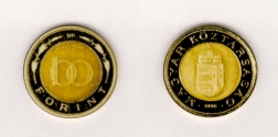
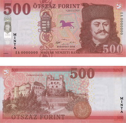
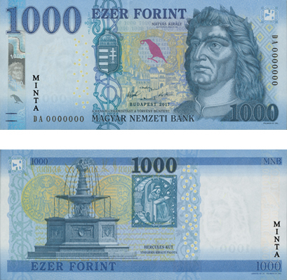
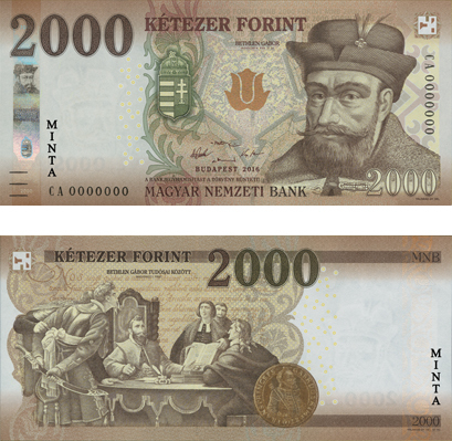
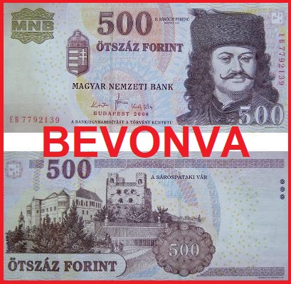
There was a replacement of banknotes in progress in Hungary between 2014 and 2019! Pay attention to the banknotes, because every type has an old and a new version! After the time limit the old banknotes are accepted only in post offices and in banks, where you can change them to the new version. The photos of all Hungarian coins and banknotes (valid and not valid ones) are the following:
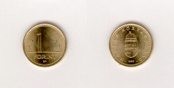
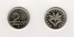
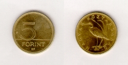
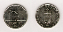
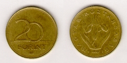
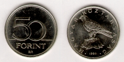
COINS:
The small changes are the following: 5, 10, 20, 50, 100 and 200 HUF - the 1 and 2 HUF coins were withdrawn from circulation in March 2008.

BANKNOTES:
These photos show the new versions of the Hungarian currencies. You can accept and pay with them without any limitation. The text "MINTA" is not on the banknote in the reality, it means the photo is only a sample about the original banknote!
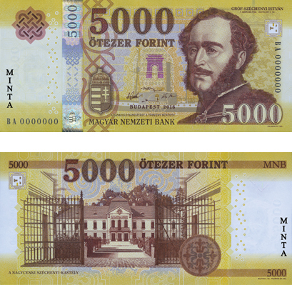
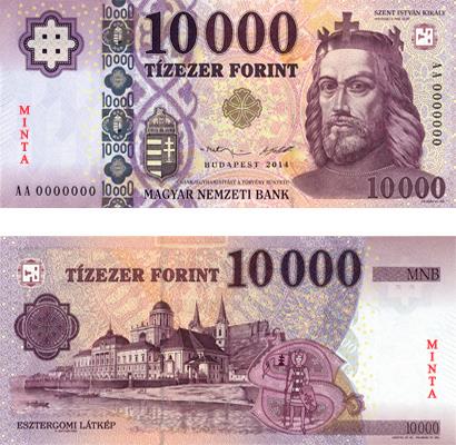
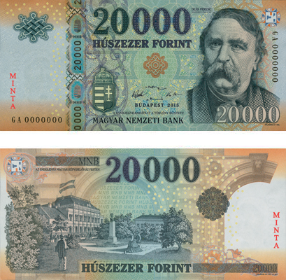
The following photos show the old version of the Hungarian currenies. Those banknotes, which you can see in red frame with the red “BEVONVA” text, are already withdrawn from the circulation. The old version of 10000 HUF banknote is in circulation without any time limit.
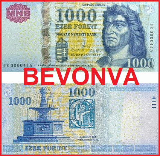
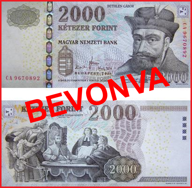
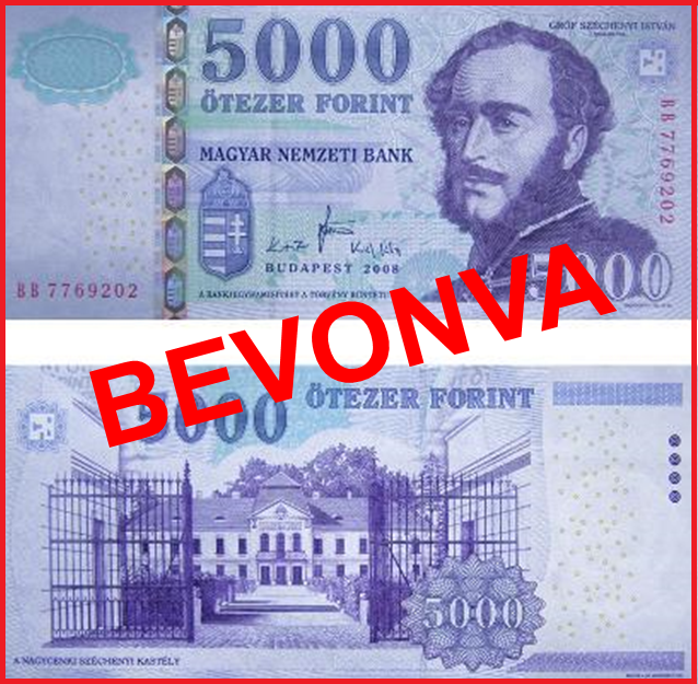
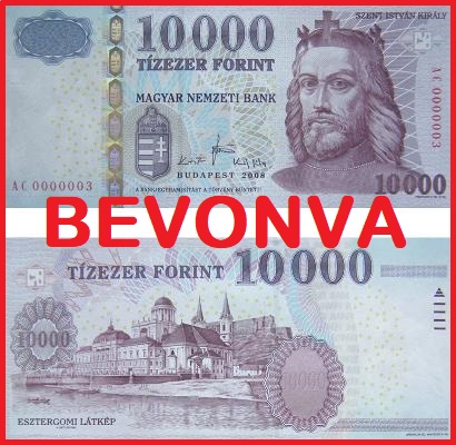
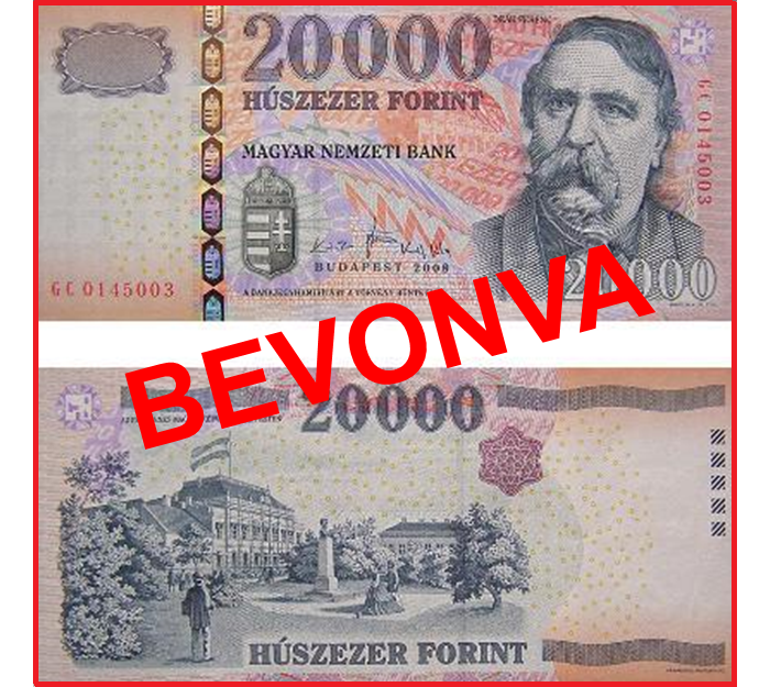
The Hungarian shops, accommodations, restaurants accept only Forint - Euro is accepted only in the bigger hotels. So you have to change money somewhere after your arrival. There are money-changer offices at the railway stations and at the airports. You can change money at almost every bank in Budapest or in the countryside. 1 Euro is about 320-340 Forint at the different money changers (December 2019). But you can find exact data about the currency rates of the Hungarian Forint to the other currencies here: http://napiarfolyam.hu
If you will pay with Forint, you have to know, that the shop assistants don't like the big banknotes - 10.000 and 20.000 Forint - in the small shops, particularly in the villages.
Even the smallest villages have a small grocery, food and drink shop. These small shops open in relative early time, between 4-6 a.m. For this reason they close in the early afternoon, or they keep a longer lunch break. Don't expect a big selection in these groceries! Fresh bread and bakery are only in the early morning, but they have packed durable bread, mineral water and tins continuously. Other products: a few type of sausages, cheese, a few vegetable, cheap beer, wine, cola, chocolates. You will find bigger shops, generally Tesco, Auchan, Aldi, Lidl in towns. They are open between 6 a.m. and 6-8 p.m.
ATM machines are everywhere in the towns and in bigger villages, generally at the banks, in the shopping centres, super- and hypermarkets. These machines accept the VISA, Eurocard/Mastercard and American Express credit cards. Of course you can use credit cards to pay with them in different super- and hypermarkets, in the shopping centres and in other shops and restaurants in the towns. Contrarily the use of cards in the countryside is not as widespread as in the towns. Almost sure, that you can’t use them in the shops, pubs, smaller restaurants and guest houses in the villages! The situation is the same at the tourist hostels, as well.
So, you have to keep cash always in your wallit for the costs of the next 4-5 day, until you will reach the next ATM!
Perhaps it is a little bit strange thing for you, but generally Hungarian people don't speak any foreign languages! Why? This is mainly the heritage of the former, socialistic system. On the one hand people could not visit other countries through the closed borders, on the other hand children learned the Russian language in the schools and never used it in the reality. So people didn't need the knowledge of any foreign languages.
Of course this situation has changed after the system change, as well. Children study generally English and/or German in the school, so you can speak a few words with the younger generation about the most important things. Nowadays about the 20% of people can speak one foreign language, they live mainly in towns. If you would like to get some information, look for and ask rather younger people.
Usually Hungarian people are helpful, they help certainly the aliens. They are very glad, if somebody greet them with Hungarian words, and they will explain the things with gesticulation.
Some useful Hungarian phrases and words:
The Hungarian is a polite nation, we use generally the “kívánok” (I wish) word in the greetings.
- Jó reggelt (kívánok)! - (I wish) Good morning!
- Jó napot (kívánok)! - (I wish) Good day! - general greeting through the whole day
- Jó estét (kívánok)! - (I wish) Good evening!
- Jó éjszakát (kívánok)! - (I wish) Good night!
- Viszontlátásra - See you later, goodbye
- Hello! - general greeting at the younger generation
- Hol van... - Where is...
- Hol találok... - Where can I find...
- mennyi... - how many, how much...
- kérem - please
- köszönöm - thank you
- szállás - accommodation
- bolt - shop
There is a very good website in English, where you can find the explanation of the Hungarian pronunciation with sound examples. On the one hand this is a very easy thing, because every Hungarian vowel and consonant has only one good pronunciation, on the other hand there are 44 characters in the Hungarian language with the short and long vowels, with the simple, double and triple consonants! So if you are interested in the Hungarian language and pronunciation, visit this webpage, please! Its address: http://www.hungarotips.com/hungarian
But the chapter about the Hungarian language is only a part of this site, you can find here a lot of other information about the Hungarian culture, tradition, foods, famous people, etc.
If you walk through a Hungarian settlement, you will see the main difference between a West-European (or American) and Hungarian village. There are high wooden or metal fences around every yards! What is its reason? There is a Hungarian saying: My house is my castle. And people keep this saying! But there are guards in the yards similar to the castles and fortresses, as well!
Generally people keep dog at home in the countryside of Hungary, especially in the villages. But these dogs aren't the pets of the family, they have an own job: to guard the house and the yard. These animals mustn't enter the house - usually they live their life in the gardens, yards of houses!
These dogs are trained to signal with barking, when anybody approach to the house. They bark onto everybody: onto the postman, the policeman, the neighbours, generally every people! You have to accept that thing, if you go through a Hungarian village, you will escorted by the barking of dogs!
Fortunately people are consistent: beside the guards they keep closed the gate of the castle - in other words the gate of the yard. If you want something from a family, you have to ring. The button is always on the post of the gate! You have to know, even the best friend of the family comes, he/she have to wait at the closed gate until the master of the dog comes, shows to the dog that the visitor is a friend and open the gate!
There are such smaller factories, plants or premises in the countryside, where the gate isn't permanently closed. In this case dogs are on chain generally - my opinion, that this is cruelty of animals - or they are trained not to leave the area of the yards.
So dogs never leave the yard to follow anybody, they know that the border of their “empire” is the fence. If a dog escape from the yard and go to loaf around, or you meet with an ownerless, stray dog, it will get out from your way, without any barking. But this situation happens really very rarely.
But if after all you afraid of dog, buy an ultrasonic dog alarm - it will protect you hundred percently! But don't use it unnecessarily, when you and the dog are on different sides of the fences!
Every foreign visitor is interested in this topic, because we have a very bad reputation in connection of Gypsies all over the world. I try to tell you the story of the Hungarian Roma people with my own words, because you can hardly find written documents in this topic. Why? I would like to explain it. Notice: The Roma and the Gipsy/Gypsy words have the same meaning in Hungarian, I will use them alternately. But it is more difficult to find a name for those people, who are not Gypsy/Roma. These people are the majority of the whole society, I will call them “Hungarians”
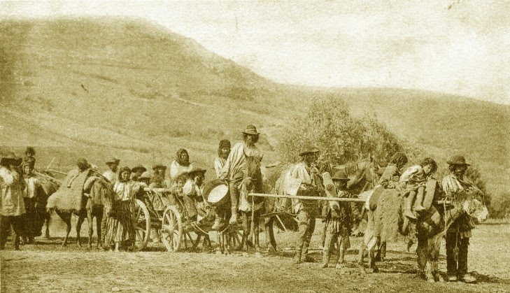
Wandering Gypsies somewhere on the countryside in the 19th century
The Gypsies appeared in Hungary in the area of the recent Slovakia first in the 14th century. According to the historical sources they came from the Middle East, from India. Later Gypsies spread in the whole country and they got protection from King Luxemburgi Zsigmond (Sigismund of Luxembourg), so they could wander and live without any restriction in the area of the former Hungarian Kingdom. A part of them moved on towards Western Europe, but the free wandering was forbidden for the Roma people in those countries, so they came back after a while and stayed in Hungary. This is the explanation of the big number of the Gypsies in the area of the former Hungary (recent Hungary, Slovakia, eastern part of Ukraine, Romania, northern part of Serbia). Although the Habsburgs - Queen Mária Terézia (Maria Theresa) and II. József (Joseph II.) tried to settle the Gypsies in the 18th century, they kept their freedom partly until the 20th century. But slowly Gypsy plants were built up at the borders of the settlements. After the World War 1 the government prohibited the free wandering of Roma people, but my mother still saw Gypsy caravans to travel through her village in the vicinity of Budapest in the 1930s. Unfortunately they didn’t have any organised job, they tried to live from different works: they bought and sold horses on the market, they made baskets and wooden tubs, they were the blacksmiths, etc.
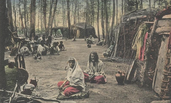
Gipsy camp in the forest in the 19th century
But there was a big change after the World War 2. The work was a compulsory thing in the socialistic system; the law punished unemployed people. The Roma people went in the factories and did the simplest jobs, which didn’t need much knowledge, or they stayed in villages and worked in farmers’ co-operatives. The ugly Roma quarters began to disappear, the education was almost complete in the elementary schools. Gypsies had permanent earning from their work and they got support to upbringing their children: family allowance – as every other Hungarian family. It seemed, the situation of Gypsies got better, but the system change came at the end of the 1980s.
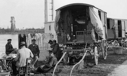
Gipsy coach in the 1920's
The uneconomic factories were closed, the farmers’ co-operatives disappeared because of the division of arable lands. The big towns in the vicinity of Cserehát Hills: Miskolc, Diósgyőr and Ózd had big steel and iron factories, all of their workers became unemployed in the 1990s. The better educated „Hungarian” people moved to another places to find a new job, but Gypsies stayed there. The change of the population began in that time: the cheap houses were bought by Roma people, the rest of „Hungarian” people escaped from the settlements. Only the old pensioners left in those villages.
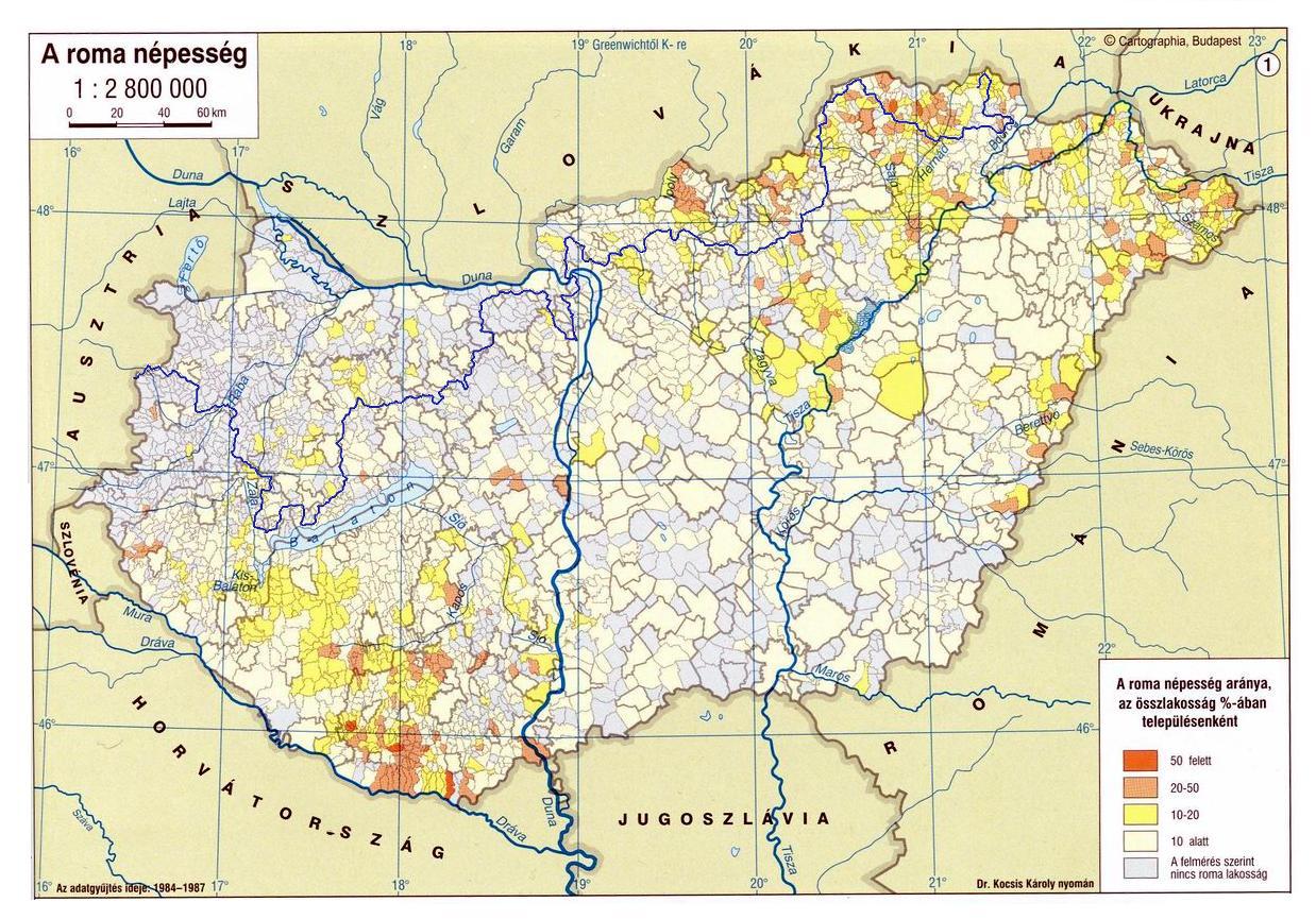
THE GIPSIES IN THE PERCENTAGE OF THE WHOLE POPULATION IN 1987 WITH THE ROUTE OF BLUE TRAIL
If you click onto the map, it will open in bigger size.
I have found a map in the secondary school's geographical map collection of my daughter about the population of the Roma people in the percentage of the whole population of Hungary before the regime change. The survey happened between 1984 and 1987, as you can see on the left-bottom side of the map. I put the route of the Blue Trail onto this map.
Although my daughter studied after the regime change, this map was forgotten in the collection (explanation later)! The percentage of the Roma population was the biggest in the Cserehát (north-eastern region) and in the Baranya region (south-western region). The situation have gotten worse since that time because of the change of population. The Blue Trail goes across the Cserehát region, but avoids Baranya county, as you can see on the map.
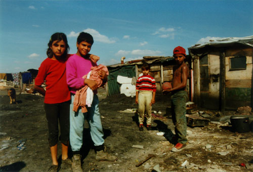
Gypsies in Hungary - Present situation 1.
The mentioned movement of the Roma people became a real deadlock: now they don’t have any earning in the small settlements, so they cannot escape from this situation! Nevertheless they could find a half-solution: this is the family allowance, which is about 13.000 HUF (about 40 Euro) for every child! The solution is to reproduce yourself! Girls begin to bear in very young age: usually a 15-16 years old “woman” already has children, and the number of the children is very high (4-6) in the families. A real population explosion happened in the Gypsie society in the past almost 30 years!
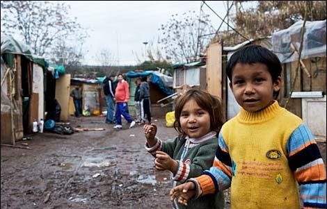
Gypsies in Hungary - Present situation 2.
But this is the biggest dead-end for the Gypsies and the Hungarian state, as well! Roma people cannot understand that on the one hand the support is bigger if women bear more children, but on the other hand the earning is the same few Forints at every child! The amount of the monetary support with the dole (aid for unemployed people) is always bigger and bigger, and it will reach that limit soon, what the government – or the whole Hungarian nation – do not able to pay! Unfortunately the crisis of the world economic in 2008 made more serious situation! Many thousands of working people had lost their job and needed dole, as well! It is fact, Hungary had the lowest percentage of working people among the whole population in the European Union in that time: it was hardly 30%!
At present the most part of Roma people live in the deepest destitution, and I see, there is hardly any possibility to escape from this situation! The Gypsies have to eat up everything in their environs because of the lack of appropriate earnings, they cut and fire the trees of the forests, destroy the empty houses of the settlements - these are the former houses of the escaped “Hungarian” people -, and try to sell every valuable thing of them. The wealthy Roma people borrow money with very high interest for the poor ones, they have to pay it back from the few family support, and unfortunately the delinquency spreads more and more among the Gypsies.
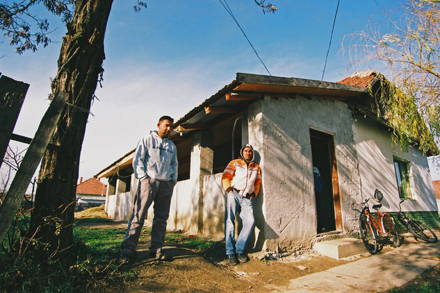
Gypsies in Hungary - Present situation 3.
A new idea was born at the 1990’s: the “subsistence criminality”! This concept is linked to Mr. Gábor Kuncze, to the former liberal minister of interior affairs. It is exactly the opposite of the “zero tolerance”, because the subsistence criminality means, we have to be indulgent with the Roma people, if they steal cheap things, because it is necessary for their everyday life!
These things are very well-known in Hungary, but we take the “democracy” in the wrong sense and a lot of people believe that we would harm the human rights, if we took difference between people and we say: there are Roma and not Roma people. Doesn’t exist any statistic about the exact number of Roma people, about the Roma delinquency, because we must not take any difference among people! This is the effort of the so-called “political correctness” or in short: PC. But we can see, there are whole counties in Hungary, where only they live (manly in Cserehát Hills and Baranya Region) and this situation is a really Catch-22! The situation is similar in other regions of Hungary, as well, but they aren’t in majority on those places, only in the mentioned parts of the country.
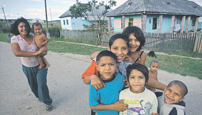
Gypsies in Hungary - Present situation 4.
Hungarian people feel that we are not able to keep almost one million unemployed Roma and see, that the delinquency gets bigger and bigger among them. Their sin is small: they steal the food and the money which is necessary to their life, but the society cannot accept the behaviour of Roma people, and the tolerance is always smaller. Gypsies steal from their “Hungarian” neighbours in the mixed villages, and the Police is powerless against the million tiny stealing and against the growing number of serious crimes, too. But one thing is sure: Gypsies do not condemn those members of the Roma society, who steal for his own subsistence from the “Hungarians”. The Magyar Gárda – Hungarian Guards – was founded by right-sided people to protect the society from the “Roma Risk”, and although it is out of law already, it has a lot of follower.
Of course, Roma people feel the danger, as well, some of them tried to move abroad, to ask for political asylum in different countries, for example in Sweden or in Canada, and a few families travelled in Strasburg some years ago. Unfortunately these countries do not keep open house for Roma people, because they saw, refugees didn’t study the language, didn’t want to work, they wanted only dole and home. In some cases they restored the visa system against the Hungarian and Slovak people to stop the migration of Gypsies into the countries, or the French government sent the Roma people back in their mother countries.
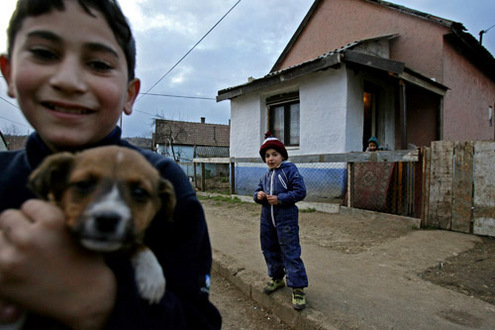
Gypsies in Hungary - Present situation 5.
I think these are the last seconds of the 24th hour! One thing is sure: we have to do something, because the whole society will crash down! The one and only solution is to lift up again the Roma people and give them permanent work. But during the last 20 years a whole Roma generation grown up without any work, and they think it is a natural thing to get dole without any work! The working society can see, that Gipsies feel pretty well in this situation and don’t want to change anything! It will be very a very hard, expensive and long procedure!
The Hungarian government launched the public work for the unemployed people in 2011, mainly in the countryside of Hungary, where the Roma population live. People, who are employed in the public work system keep the order in the villages, clean the streets or maintain the public utilities. Local governments organizes the work, unfortunately they can't employ every unemployed people, only a few months in a year because the lack of money.
The second thing is on the one hand to decrease the number of children in the very poor (Roma) families, on the second hand to increase the number of children in the whealthy families, because the statistics show, the population is decreasing and gets older and older in the country. The government launched a new family support system in 2012, it keeps the sum of the family allowance (13.000 HUF) and the inflation decreases its value continuously, but families with multiple children get besides the family allowance a significant tax discount, too. It means, working parents of minimum three children don't pay personal income tax! The results are already visible, “Hungarian” families undertake more children in the last few years and the number of newborn Gypsy children perhaps decreases very slowly.
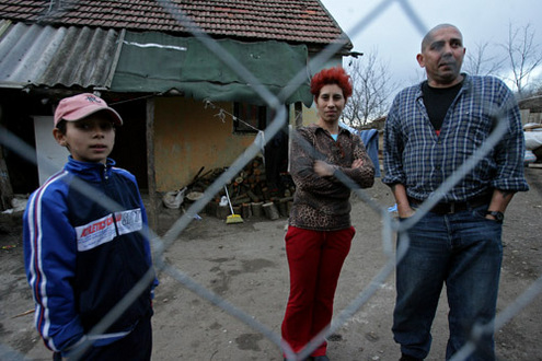
Gypsies in Hungary - Present situation 6.
The second breakout point is perhaps the education. Unfortunately Roma children can see in the family that they are able to live from the dole, the work is not an important thing. They can see that they can avoid the punishment for the subsistence criminality. The lack of motivation in the study determines their destiny: if they don’t learn, won’t have job, they will be unemployed people. They will live from the doles, and the big circle begins again!
The right-sided party named “Jobbik” has got more than 12% place in the new Hungarian Parliament on the election in 2010 and 2014. It shows that a big part of Hungarian people is waiting for strong change, and not important if that change will be hard or bloody against the Gypsies!
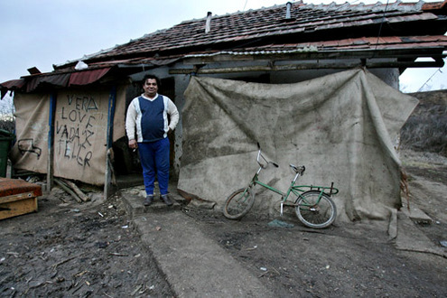
Gypsies in Hungary - Present situation 7.
The Roma culture is totally different from ours, many times I do not understand their attitude, although I lived here my whole life. Generally they do not keep order in the gardens around their houses, they live their society life on the streets, they are much louder, than other people, but it is only the surface of the great sea of differences. But after all a lot of Roma people are honest, I hiked many times among them, and until this time they stole nothing from me, I didn’t have any problem with them. The Hungarian hikers have different forums on the Internet, where we chat a lot with each other, the news spread very fast there, but nobody from the hikers have suffered any harm from the Roma people in their villages!
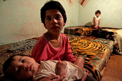
Gypsies in Hungary - Present situation 8.
When my son and I walked on the Blue Trail in the Cserehát Hills, we had accommodation in Rakacaszend village in the kindergarten, In Felsővadász village in the gym of the school and Encs in a guest house. We did not have any problem or conflict with the Roma people. They answered gladly when we asked for information, we sat together with them in the pubs, and we walked among them through the Cserehát! I think there is not any risk to travel through the Cserehát for foreign people, and the situation is the same with the accommodations! I can give only one advice: don’t show your values (mobile phone, GPS, expensive cameras, jewels, etc.) because there is a Hungarian saying: Devil never sleeps!
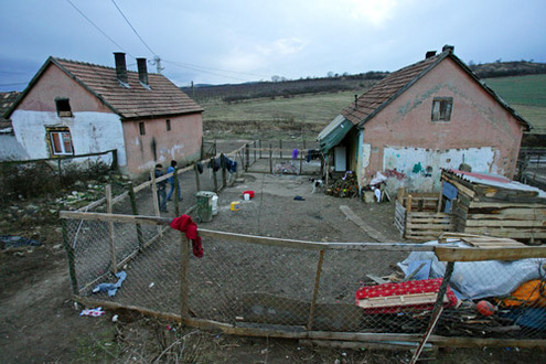
Gypsies in Hungary - Present situation 9.
Finally I have to tell you honestly again, this long article is only the opinion of mine and my hiker friends, and not the official point of view – because the official point says: There is not any Gypsy problem in Hungary. The reasons were mentioned above. If you are interested in this topic, I would like to recommend you a longer article, which was published in 2010 about the Roma problem, before the elections.
This was a little bit long chapter, but I hope, you understand better the Hungarian reality now! If you are interested in this topic read this, already mentioned stuff:
The re-evaluation of the Roma policy in Hungary
This article was on the already closed http://www.budapestanalyses.hu/ website in 2010, fortunately I downloaded it. I selected the photos about roma people in an article from the well known Hungarian photogapher, Mr. Ákos Stiller. I think these photos are the best to introduce the unimgaginable powerty and the closed world of gypsies.
Hungary has a mainly continental climate with big yearly temperature change, it has four different seasons and generally a little bit lower average temperature, than the global. The Hungarian summer is long and generally dry, the average temperature of three months (June, July and August) exceeds the 18 degrees Celsius and many times the highest temperature reach the 35 degrees Celsius. The hotter month is the July with 22 degrees Celsius average temperature. The temperature of the winter is changeable, cold and warmer times follow each other, but there is only one month (it is January) with lower average temperature, than 0 degree Celsius. Winters are usually dry, we have only rarely bigger snow, mainly in the mountains.
The yearly amount of the rainfall is changeable (600-1000 mm), it depends on the regions - among the mountains more, on the plains less, but generally the spring and the autumn are the two more wet seasons.
The amount of the sunny hours is between 1700 and 2100 - among the mountains less, on the Big Hungarian Plain is the most. Hungary do not have any seaside but it lies close to them, so our climate is influenced by three big factors: first the continental climate, but in second line the wet and mild oceanic climate and the mediterrain climate have a big effect to the Hungarian weather.
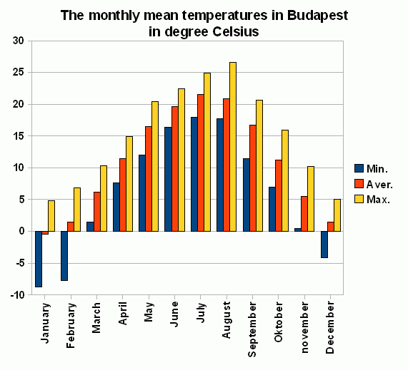
The mounthly mean temperatures in Budapest
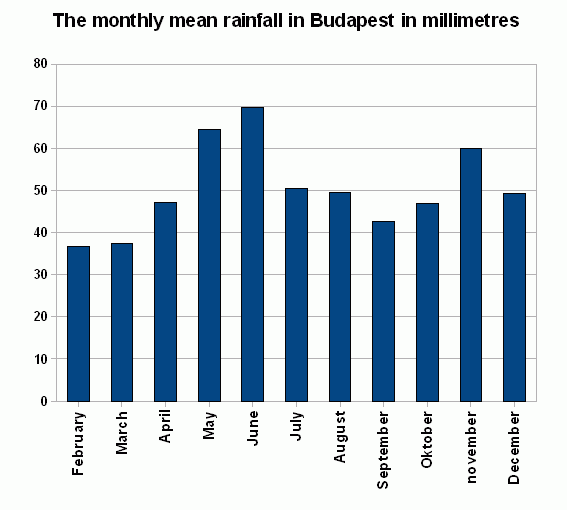
The mounthly mean rainfall in Budapest
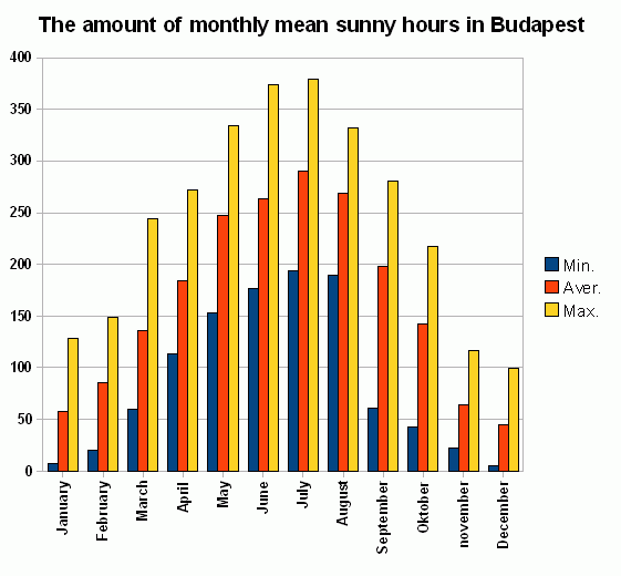
The amount of mounthly sunny hours
But what does it means in the reality? I try to explain it with simple words.
Generally the second half of April, May and early June have a lot of rain. That time the big Atlantic cyclones run through Hungary and they bring always rainfall.
Later the cyclones don't touch Hungary because generally develops a high pressure area above the Carpathian Basin and it force the weaker Atlantic cyclones onto a more northern route through the German and Polish plains. This is the time of the hot and dry Hungarian summer! Only the explosive local thunder-showers can decrease the hot. These high pressure areas live only 5-10 days, because the stonger Atlantic or Mediterranean cyclones can break through them and bring 1-3 wet and cool days. The end of this long period is usually in the second half of August. The different Mediterranean and Atlantic cyclones follow each other in the whole September, we have only short pauses among them. But generally they are “dry” and don't bring a lot of rain.
Later we have a shorter or longer sunny period in Oktober - this is the time of the Hungarian “Indian Summer” - but November is a generally wet month and the December bring the cold.
This was the description of a usual year. But the global warming has changed a lot of things in the climate of Hungary. What does it means? On the one hand the sudden changes are bigger: the cyclones are more stormy and powerful after the dry and very hot periods, on the other hand the difference among the same seasons are bigger. For example the summer of 2006 was very wet, but in 2007 we didn't see any rain! 2008 and 2009 were two average years, but 2010 was the rainiest year in the history of the Hungarian meteorogy!
If you plan a two weeks long hike in Hungary in any times, it is almost sure, that you will get a longer-shorter rainy period!
And finally I would like to show a few diagrams about the weather of Hungary. I have collected the data and made these graphs from the data archivum of the last 100 years' meteorology in Budapest. These data are on the website of the Institute of Meteorology. The capital is in good geographical position to explain the Hungarian weather, because it lies on the border of the northern mountains and the plain.
You can see three diagrams on the right side. Let's speak first about the temperature! The blue columns show the monthly average temperature of the coldest months in the past 100 years in Budapest, the yellow ones show the hottest months and the red ones the 100 years monthly mean temperature in Budapest.
The second graph shows that July, August, September and Oktober have the smallest rainfall between the rainy weather of the spring and autumn. But you have to remember, that these months are not totally dry! There is a big chance to get a rainy period even in the summer!
And the third one is a very interesting diagram. It shows the percentage of the sunny hours to the possible maximum. The possible maximum would be that number of the sunny hours, when on every day of the month the Sun could shine between the dawns and sunsets from the clean sky. The graph shows, that the most sunny months are the June, July, August and September in average, but the autumnal months (September and Oktober) can be either very nice, or (rarely) very bad!
More publishers have hiker maps about the Hungarian regions and mountains, they cover almost the whole route of the National Blue Trail, but only the Cartographia Company has a special tourist guide about the National Blue Trail. This company publishes and distributes the two volumes of Blue Trail Tourist guidebook.
You can buy the maps on the Internet, its address is:
http://www.cartographia.hu/. You can find the maps of the Hungarian regions and the two volumes of the Tourist guide of the National Blue Trail (name on the books: Kéktúra I.-II.) here. The travelogues of the volumes are only in Hungarian, so you perhaps will not understand the text, but the maps of the books are very useful, because they show the whole route of the Trail in scale 1:40.000 (partly in 1:60.000).
Links to books in the webshop of Cartographia map company:
The second possibility is to buy the maps and travelogues in the shop of the Cartographia. The map shop is in the downtown of Budapest, its address is 37 Bajcsy-Zsilinszky út, Budapest. You can approach it by a five minutes long walk from the M3 underground station named “Arany János utca”.
You can buy the personal completion (validation) booklet of the Blue Trail in this shop, as well. You can collect the stamps of the National Blue Trail in this small booklet, and I think it is a very useful helpmate with its exact distance and elevation data.
I put here the photos of the newest version of tourist guides, but I will tell more information about the stamping later, in other chapter.
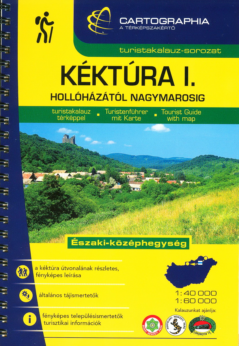
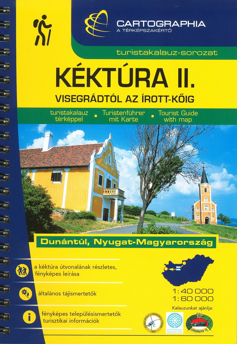
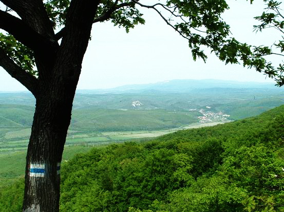
Painted signs on the ridge of Matra Mountains
The Hungarian hiker's paths are signed with painted trail marks. Their size is about 12 X 10 cm at the stripe marks, the size of the others is about 10 X 10 cm. Four colours are used: blue, red, green and yellow. The paths are signed in both directions. The work of the painters is good, if you can see the next mark from the previous one. The trail marks are painted more often at forking or crossing place of different signed paths. If the route of the paths is unambiguous - for example it goes on good dirt roads or in line cuts through the forest, you will find the marks more rarely.
Let's see now the different marks:
| Name: | Sign: | Written: | Description: |
| Stripes |     |
K, P, Z, S | These main signs cross whole mountains or regions in Hungary. They begin at those places, which are good accessible with public transport vehicles (train, coaches, etc.). Signs in the map: K (blue), P (red), Z (green) and S (yellow). |
| Crosses |     |
K+, P+, Z+, S+ | The paths are signed with this trail marks, begin at the route of the main signs and generally they offer some other possibilities parallel with the main route to reach your target. Signs in the map: K+ (blue cross), P+ (red cross), Z+ (green cross) and S+ (yellow cross). |
| Squares |     |
K□, P□, Z□, S□ | Their paths begin at the main trail markings and they lead to some populated places, tourist hostels or to the stop of public transport vehicles. Signs in the map: K□ (blue square), P□ (red square), Z□ (green square) and S□ (yellow square). |
| Triangles |     |
KΔ, PΔ, ZΔ, SΔ | These paths lead to the peaks of mountains or to other good lookout points. Signs in the map: KΔ (blue triangle), PΔ (red traingle), ZΔ (green triangle) and SΔ (yellow triangle). |
| Circles |     |
KO, PO, ZO, SO | These paths go to permanent, built springs. Signs in the map: KO (blue circle), PO (red circle), ZO (green circle) and SO (yellow circle). |
| Omegas |     |
KΩ, PΩ, ZΩ, SΩ | These signed paths go to caves or gorges. Signs in the map: KΩ (blue omega), PΩ (red omega), ZΩ (green omega) and SΩ (yellow omega). |
| Round tours |     |
KC, PC, ZC, SC | Their starting and finishing points are the same and they visit generally more sights from the paths of the main trail marks. Signs in the map: KC (blue round arrow), PC (red round arrow), ZC (green round arrow) and SC (yellow round arrow). |
| Ruins |     |
KL, PL, ZL, SL | The paths, which are signed with these trail marks, go to some ruined castles, monasteries or to other built sights from the main route. Signs in the map: KL (blue ruins), PL (red ruins), ZL (green ruins) an SL (yellow ruins). |
All of the paths are signed with red lines in the maps, and different characters show the colour and type of the path. This a very easy and clean thing, but many times the different signed routes use the same way! In this case you can find more signs on a tree, and more characters beside the red line of the path in the map. I show you a small map detail about the environs of Dobogókő, which is a well-known center of the different signed paths. Try to recognise the signing characters of the paths in it!

Map detail about the environs of Dobogókő
I would like to recommend two softwares, they can run on mobile phones under the Locus map. Both of them show the whole net of Hungarian hiker paths, of course together with the route of the National Blue Trail. The first is the Mapforge, its appearance is similar to the hiker maps, but it shows the the different paths with their original signs, de second one is the Openstreetmap, here the routes are marked with the characters, which are written above in the chart. Of course you can install them on hiker GPS, as well. You can download them from here:
Well, it is a difficult question. As I wrote, a very important part in the life of a Hungarian hiker to complete the whole National Blue Trail. If we collect every stamp along the trail in our booklet, we will get a small badge from the Hungarian Rambler's Association. But you will complete during your hike only a shorter or longer section of the more than 1100 km long trail. In this case you don't have to collect the stamps, only walk on the route and admire the wonderful countryside of Hungary. But to collect the stamps is a very good entertainment during the hike!
If you decide to walk along a section of the Blue Trail, you can choose among those, which have an own prize. They are written in the chapter of the badges. But if you choose other sections, the personal completion booklet with the stamps of the completed distance can be a very nice relic of your Hungarian hike! If you want to stamp during the hike, you will find some advices in the next chapter.
You can order it from the Hungarian Rambler's Association. You must write a letter to the association (its postal address is: Magyar Természetjáró Szövetség, 1244 Budapest, Pf.: 846.) and they will post the booklet to your address. You will pay at the delivery. The price of the booklet is 1260 HUF (about 4 Euro).
You can buy it in the central office of the Hungarian Rambler's Accociation in Budapest. Its address is: 11 Károly körút, Budapest. The office building is located exactly in the centre of Budapest, you can reach it with five minutes walk from the underground station named „Deák tér”. The office of the association is on the seventh floor. Costumer reception is on every working day between 9 a.m. and 4 p.m.
Of course you can buy the personal validation booklet and other maps and books in the TuristaShop, which is the webshop of the Hungarian Rambler's Association.
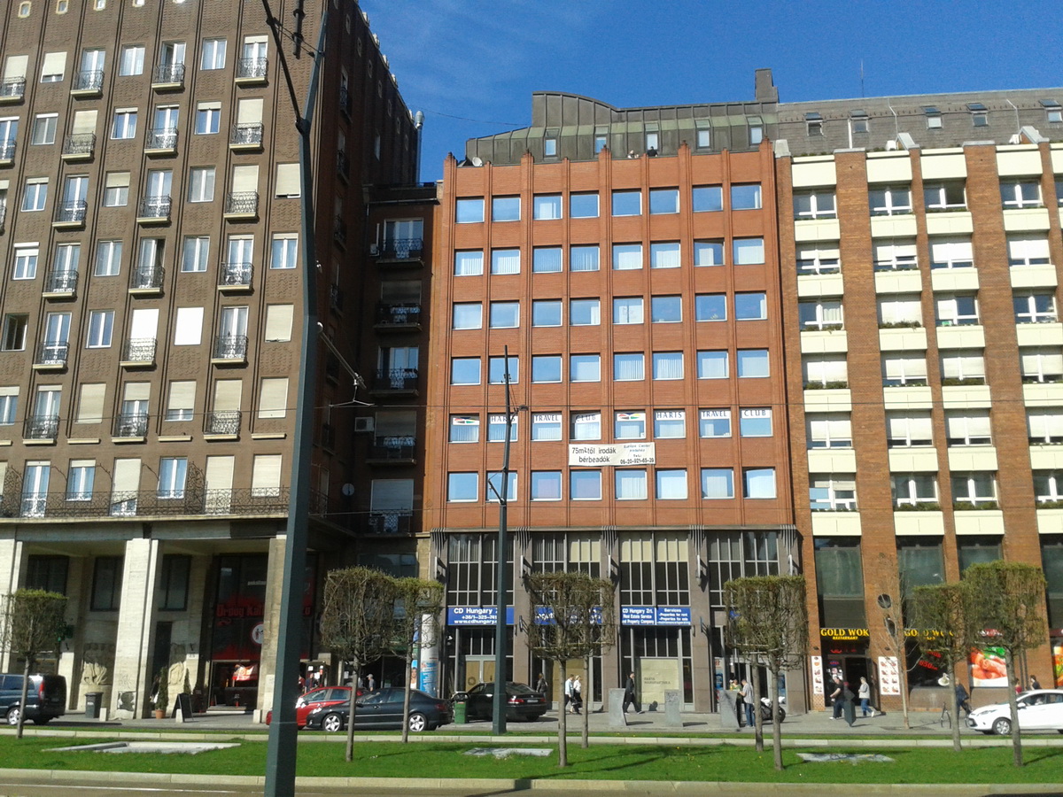
The central office of the Hungarian Rambler's Association is located in this building on the seventh floor
The National Blue Trail has 150 stamping places, where you have to prove the fact, that you were there. A lot of stamps are located in the shops or pubs of the settlement, which are on the route of the Blue Trail, but you will find stamps in their own metal boxes in the forest, generally equipped on the trees. There is a very good forum, where the hikers share their experiences regarding to the stamps of the Blue Trail: http://www.teljesitmenyturazoktarsasaga.hu/okt_forum. You will see the whole list of the stamping places on the opening page. If you click on the name of a place, its subpage will open with the comments. The newest comments are on top. Of course, it is only in Hungarian, but there are already good translator softwares on mobile phones and tablets.
The Hungarian Rambler's Association has an official record about the stamping places, it downloadable from this place. It is a PDF document and it is in Hungarian, as well.
It is a very simple thing: there are squares (boxes) with the name of the stamping places in your personal completion booklet. You must push the stamp into the appropriate square. Of course you need a good ink pad to do this thing, because of the infrequent use the stamps are generally dry. There are places beside the boxes of stamps to write the date of your visit at the stamping place. If you interrupt your hike at a stamping place, and later you continue the hike from that place, you have to write two dates beside the box of stamp, but if you stop only for the stamping at a place, and continue the hike immediatelly, you can write only one date in the booklet.
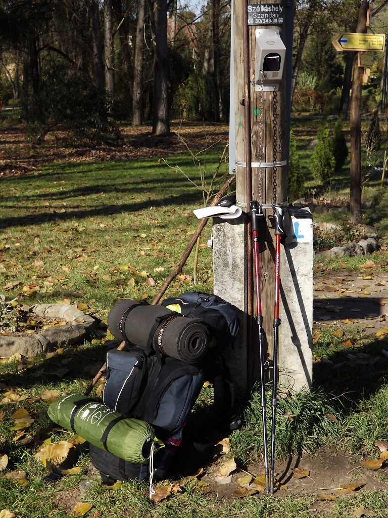
The stamping place in Szandaváralja village. I am stamping in an older version of the booklet.
What happens, if you don't find the stamp, or it is unusable? Appropriate verification could be the stamp of any other company, establishment, local government, school, drug store, agricultural cooperative, community centre, committee or contractor, on which appears the name of the stamping place. It is possible to get a dated (cancellation) stamp in the post offices, but in that case the Hungarian Post may ask you to buy one (sticking) stamp in the brochure. If you can't find any other stamp (for example it happens at a forester's lodge in the woods), you must take a photo about you and the stamping place together (a selfie with the stamping place). One thing is relevant: you and the stamping place must be recognizable!
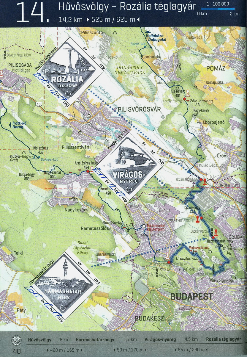
A page of my personal validation booklet with stamps
You must hand over the personal completion booklet to the Hungarian Rambler's Accociation (if you completed the whole Blue Trail) or to the local rambler's association for the region badges. If you would like to obtain the badges of the Children's Blue Trail for your child, it happens at the Hungarian Rambler's Association. You can either post the booklet to the associations, or hand it over personally in the offices. The evaluation process keeps for one-two weeks. If you don't have enough time to wait until its finish in Hungary, give your postal address at the reception and pay the cost of the postal expenses, they will post the badge and the evaluated booklet for you.
| The name of the hosting provider: | Port Kft. |
| The postal address of the hosting provider: | 9200 Mosonmagyaróvár, Szent István király út 60. |
| E-mail address of the hosting provider: | info@webtar.hu |
| The name of the author and editor of the website: | Horváth Béla |
| E-mail address of the author and editor: | horvabe1959@gmail.com |
| The information on this website is true and complete to the best of the author's knowledge. All recommendations are made without guarantee on the part of the author. The author disclaims any liability in connection with the use of this information. | |
 Creative Commons license: Attribution-NonCommercial-NoDerivatives 4.0 International Creative Commons license: Attribution-NonCommercial-NoDerivatives 4.0 International | |
| Please read the Cookie Policy of this website! It contains important information! | |

